
User Controls
Rocket possibly aiming for DC
-
2021-05-06 at 6:01 AM UTCand i will correct myself. its not LOS. its LSO.
-
2021-05-06 at 6:02 AM UTC
Originally posted by Quick Mix Ready tokyo and Korean 37th/38th parallel are due west of San Francisco because it too borders the same parallel some 6800 miles away. Alaska is not on this latitude

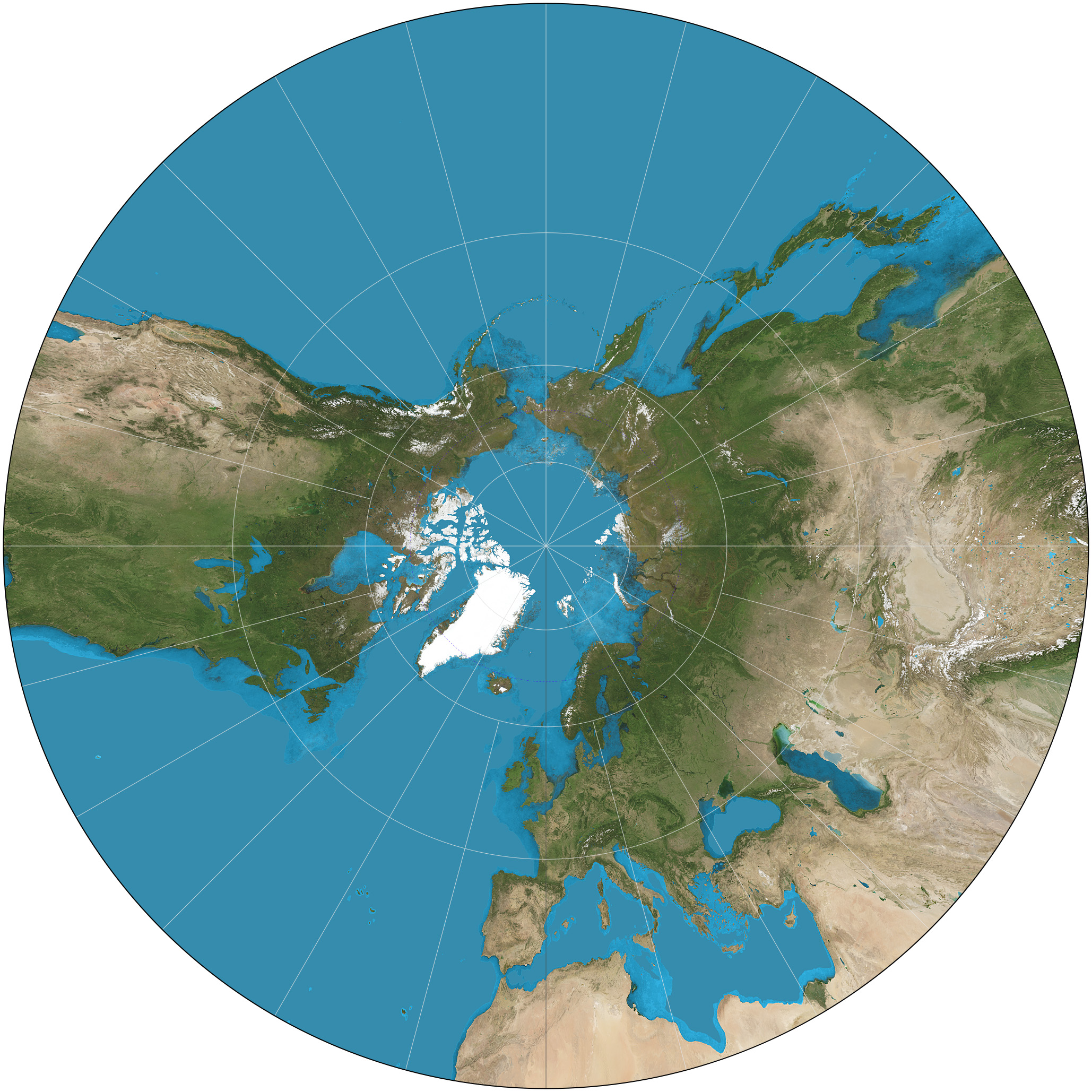
Fun fact, the Earth is a sphere and maps are not. The only map projection in which a straight line travelled across the surface of the Earth appears as a straight line on a map is this:
If you are using any other map projection, plotting any straight path will result in a curved line.
Did you never get your orienteering badge? -
2021-05-06 at 6:05 AM UTC
Originally posted by Quick Mix Ready see what you did. you went and looked up something and read it out of context
get back into the kitchen and finish off snipping your vital parts
You literally think the thing G linked is a "controlled orbital trajectory" because you don't understand map projections. Whatever, you're beyond helping.
You're right. Jeff Hunter tasked me with leading you astray but clearly he didn't anticipate the vasty depths of your orienteering and rocket science knowledge. I've failed. -
2021-05-06 at 6:13 AM UTCI hope it lands directly on someone's McMansion and flattens it
-
2021-05-06 at 6:13 AM UTCno,
the great circle route is based on altitude bulge. which occures at the equator. the tallest mountain is Mt Everest at 37,000 feet while the second tallest range outside of asias is in the Andes mountain range. nearly 10,000 feet shorter. i spoke about this in another thread just last week.
however the tallest mountain in western hem is South Americas Andes region near the Eqator. yet it is higher up in the biosphere because of the buldge which throws off altometers. this was a mystery until lasers on satellites could prove this theory as fact. this is why planes traverse the pole regions. the equator also creates huge turbulance and outside of the two horns (south america and south africa) the eqator is one of the most dangerous places to travel by boat or plane. -
2021-05-06 at 6:14 AM UTCThe following users say it would be alright if the author of this post didn't die in a fire!
-
2021-05-06 at 6:17 AM UTC
Originally posted by Meikai You literally think the thing G linked is a "controlled orbital trajectory" because you don't understand map projections. Whatever, you're beyond helping.

once again, queer. G's map is showing the payload and not the rocket itself. it is following the ISS at twice the speed to catch up.. it has cold gas thrusters to slow it down to dock with the ISS -
2021-05-06 at 6:23 AM UTC
Originally posted by Meikai I hope it lands in Yellowstone and sets off the super volcano so schizos like OP can have a disaster porn twofer.
San Francisco is on the outer circle of destruction. wind carrys east on top of that (except santa anna ) so its going to dump nicely on Toronto, Chicago, Ohio, Indiana, etc etc. wiping out 2/3rds of the remaing board. nice wishfulness, Sucka!
look up polar trajectory regarding the Starlink and why they chose to use that direction instead of East to West -
2021-05-06 at 6:26 AM UTC
Originally posted by Quick Mix Ready once again, queer. G's map is showing the payload and not the rocket itself. it is following the ISS at twice the speed to catch up.. it has cold gas thrusters to slow it down to dock with the ISS
It wasn't being delivered to the ISS... it was the core module of the Tiangong Space Station, which is intended to orbit at ~370km (read: 1.5x the altitude of the ISS). The page G linked is tracking the altitude of the object, which is currently ~265km (and falling). It's not tracking the payload, which was delivered and remains at 370km. -
2021-05-06 at 6:31 AM UTCThis is the payload: https://orbit.ing-now.com/satellite/48274/2021-035a/tianhe/
-
2021-05-06 at 6:34 AM UTCTake your meds. Or stop taking your meds, if you've been taking Adderall. Whatever makes you less retarded.
-
2021-05-06 at 6:41 AM UTC

the initial blast region will level homes for 500 miles or so. the secondary zone localized said it could cover houses from 50-100 feet deep in ash usually heavier bolders and rocks, the thinner ash gets blown into the biosphere
The Tertiary zone will barely cover Chicago area with 2-5 feet of ash, However the Secondary Zone will hover above for awhile and then re-settle again down hard covering most central and east coast with up to 20 feet in more finite ash.like talcum powder -
2021-05-06 at 6:44 AM UTC
Originally posted by Quick Mix Ready

the initial blast region will level homes for 500 miles or so. the secondary zone localized said it could cover houses from 50-100 feet deep in ash usually heavier bolders and rocks, the thinner ash gets blown into the biosphere
The Tertiary zone will barely cover Chicago area with 2-5 feet of ash, However the Secondary Zone will hover above for awhile and then re-settle again down hard covering most central and east coast with up to 20 feet in more finite ash.like talcum powder
-
2021-05-06 at 6:44 AM UTCWhat a fucking spaz lol.
-
2021-05-06 at 6:44 AM UTC
-
2021-05-06 at 6:46 AM UTC
-
2021-05-06 at 8:08 AM UTCThe following users say it would be alright if the author of this post didn't die in a fire!
-
2021-05-06 at 12:24 PM UTC
-
2021-05-06 at 12:32 PM UTC
-
2021-05-06 at 1:44 PM UTC